Product description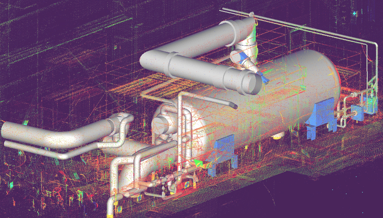
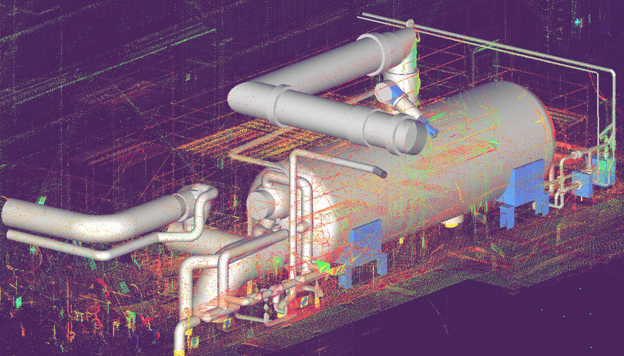
Laser scanning technology allows highly accurate three-dimensional models of industrial facility structures and components to be obtained.
These “as built†models represent the actual status of the facility at the moment of study, for which reason they are particularly useful for task planning, personnel training and the simulation of manoeuvres, especially in areas of difficult access or severe environmental conditions. The models may be exported to CAD type design programmes (AutoCad, Microstation) or to *.pdf format file for those not requiring specific training.
Thanks to the preliminary topography work, all the elements scanned may be referred to a common and integrated system of coordinates. This allows panoramic displays to be obtained in web environments that make it possible to move around the actual plant environment, identify components, obtain coordinates, measure distances in three dimensions and identify interferences without the need to be physically in the working zone.
Technical characteristics
- Visual power. Acquisition of 3D models compatible with CAD programmes
- Accuracy. Generation of highly detailed “as built†drawings.
- Versatility. Possibility of integration with databases and of obtaining specific products / applications.
- Accessibility. Generation of panoramic “2½ D†environments in web data servers.
- Development of 3D models accessible at user level with conventional software and without the need for specific training
Applications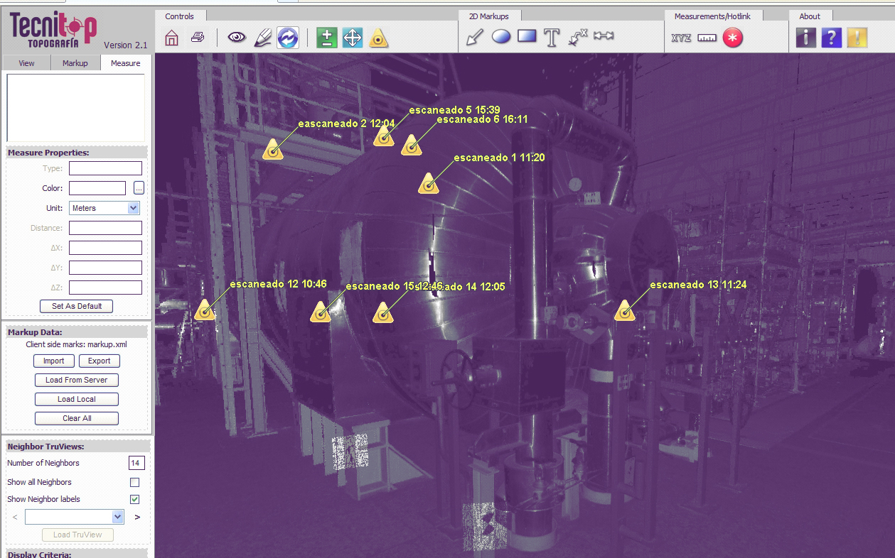
- Acquisition of actual elevation piping drawings for engineering analysis.
- Inverse engineering. Modelling of components for the planning of equipment design changes.
- Dynamic components and tools search engines for work planning.
- Personnel training, virtual inaccessible area walk-throughs.
- Graphic window for database access from real 3D environments.
References
- ASCO 1 NPP
- ASCO 2 NPP
- VANDELLOS 2 NPP
- ALMARAZ 1 NPP
- ALMARAZ 2 NPP

